The Thermae Diocletiani (Baths of Diocletian) were built from 298 to 306 CE in Rome. They occupied an area of about 130,000 sq.m..
The building works were started under the emperors Diocletianus and Maximianus (both named Augustii after the introduction, by Diocletianus himself, of the new governance model called “tetrarchy”) and, after their abdication, completed under Costantius “Chlorus” (father of Costantinus “the Great” and Augustus for the pars occidentalis of the Empire from 305 to 306 CE).
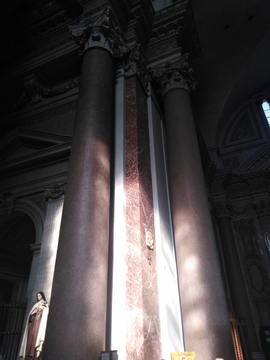
In the 16th century, under the reign of Pope Pius IV, within the ancient remains of the Thermae, Michelangelo Buonarroti, at the age of 86 years, started the construction of the Christian Church of “Santa Maria degli Angeli”.
In his original project, Michelangelo respected the shape and the volumes of the ancient Thermae. For instance, he preserved the eight red granite original Roman columns, which are 15 meters tall. After his death, the works were continued under the supervision of Jacopo Del Duca, nephew of that priest, Antonio, who convinced the Pope to start the building of the Church. Over time, the Church has been subject to several renovations until the 20th century.
Piazza della Repubblica
Altogether, the archaelogical remains of the Thermae were deeply impacted along the centuries by reusing part of them (e.g. as a convent or military station) or by other destructive interventions (e.g. road construction across the archaelogical area). For example, the present-day Piazza della Repubblica (former Piazza dell’Esedra) was built on the place of the ancient “exedra” of the Thermae (the two semi-circular buildings follow the exedra‘s perimeter).
Nowadays, in the monumental quarters of the ancient Baths is situated the National Roman Museum.
Here below some pictures of the monumental Roman remains.
Interior of the Church of “Santa Maria degli Angeli”, two original Roman columnsInterior of the Church of “Santa Maria degli Angeli” at the Thermae Diocletiani
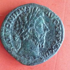
Rev. Ship Prow, above I (209-208 BC – 39 g., 33 mm.)
As/Asse -Obv. Ianus
“……nota aeris eius fuit ex altera parte Ianus geminus ex altera rostrum navis….” (Plinius Senior, Historia Naturalis, Liber XXXIII)
(M. Valentini) – The As (As, Assis) was the basic unit of the Roman monetary system. It was a bronze or copper currency (a cast coin in the beginning and a struck coin later, after the reduction of its weight).
Originally, an As likely weighed between 327 and 270 grammes, i.e. it was linked to the Roman pound standard, the libra (actually the pound in grammes of a Roman libra is still uncertain, it is believed to be in the range 327-350 grammes, while the so-called Latin libra weighed about 270 grammes). Such a heavy cast bronze coin was called “Aes grave” (Aes, Aeris in Latin means bronze or copper). It was the first circular Roman currency which followed the so-called Aes signatum, a rectangular ingot bearing a mark of the Roman authority weighing between 1.15 and 1.85 kilos (i.e. about 5 librae). At least for a certain period, the Aes grave and the Aes signatum circulated in parallel as legal tender.
The introduction of the Aes grave is also uncertain. Traditionally, it is believed that the Aes grave could be already used around the 450 BC while more recent studies suggest that it could be introduced after the 350 BC.
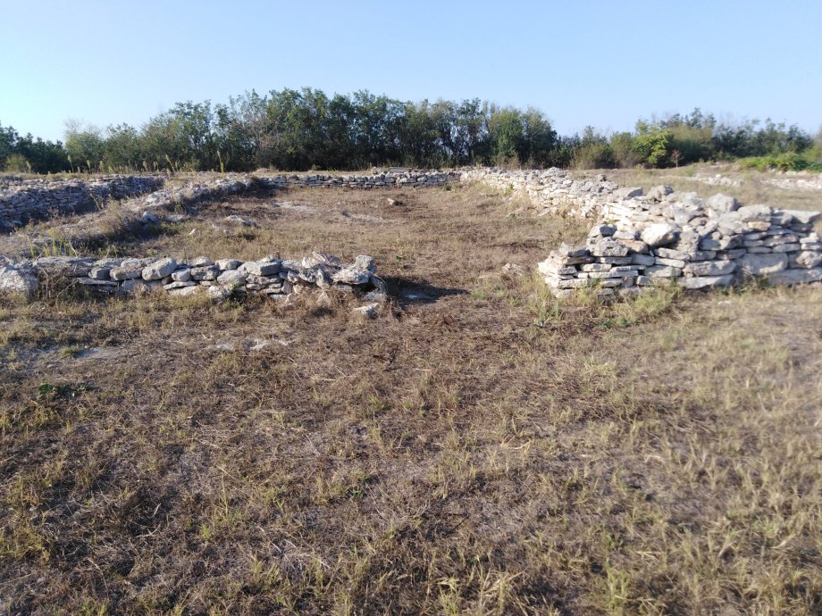
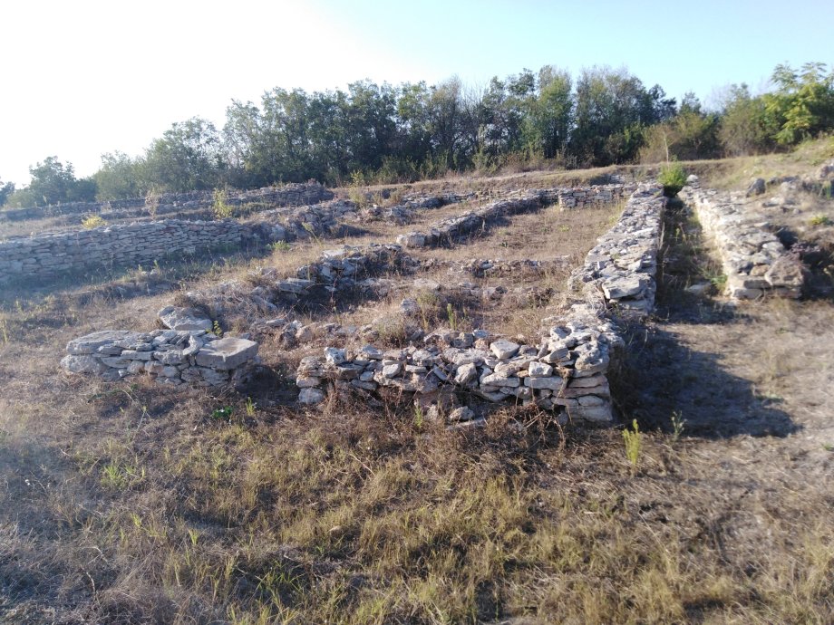
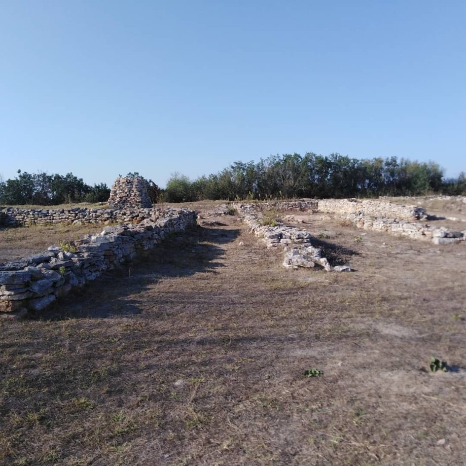
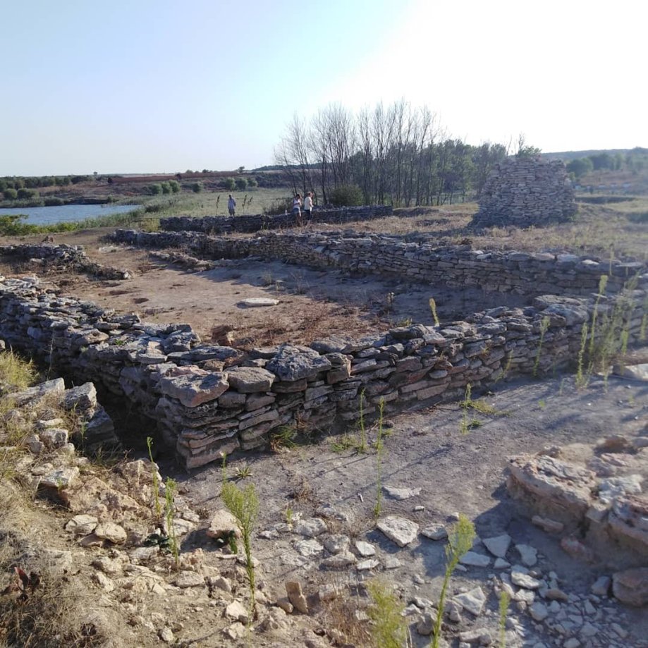
(m.v.) – Archeological excavations in the city of Varna (Bulgaria), started in the first months of the current year, unearthed the remains of the south-east gate and walls’ tower of the ancient Varna, the Greek-Roman Odessos. The findings date back to the Late Roman Empire (or Early Byzantine) period , 5th-6th century CE. The street passing through the gate, some remains of it are still visible, linked the port to the center of the City.
Here below some pictures recently taken by myself in Tzar Simeon I Square.
Ancient Roman capital, Archaelogical Museum (Cremona)
(m.v.) – Before the Roman conquest of the Gallia Cisalpina (corresponding to the present-day Val Padana, i.e. the Po river’s Valley), Cremona was a settlement of the Galli Cenomani (a Celtic Tribe). During the 2nd Punic War, in 218 BC, the Romans fortified the village that was likely transformed in a colonia under Latin Law, like other cities of the region, after the issuing of the Lex Pompeia in 89 BC (see previous post The Roman Ticinum (present-day Pavia) ).
Cremona was an important city for all the Roman period due to its key location of being at the crossroads of main commercial ways: the city was a relevant port on the Po (Padus), it was traversed by the via Postumia (which linked Genoa to Aquileia and that was built by the Roman consul Spurius Postumius Albinus in 148 BC.) and the via Regina connecting Cremona to Mediolanum (Milan) and Clavenna (Chiavenna).
It is worth mentioning the small village (vicus) of Bedriacum (present-day village of Calvatone) near Cremona where after the death of the Emperor Nero in the year 69 CE (the so-called “longus et unus annus” or the “year of the four Emperors”), two battles were fought, the first one between the armies of Otho and Vitellius and the second one between the armies of Vitellius and Vespasianus.
Moreover the village of Calvatone is famous for an ancient Roman bronze statue of a Winged Victory (Nike) found in 1836 and called “Victory of Calvatone” after the village’s name. The Statue was transferred to Germany (former Kingdom of Prussia) in 1841. The original Statue is nowadays at the HermitageMuseum in Saint Petersburg after it was brought here after the WW2 by the Soviet Army (see photo at right).
After the fall of the Western Roman Empire, Cremona was taken by the Eastern Roman Empire / Byzantine army during the war against the Goths and remained a Byzantine stronghold until the Lombards (or Longobards) occupied the city in 603.
The City had an important role also during the Medieval Age when it was often opposed to other neighborhood cities such as Milan or Parma. Many impressive churches and building of the Medieval times may be still admired in the city, notably the Santa Maria Assunta’s Cathedral (whose construction started in the 12th century) with its bell tower called Torrazzo, the Baptistery or the Palazzo Comunale(the City Hall, 13th century).
Cathedral S. Maria Assunta
Baptistery
City Hall
The remains of the Roman period still visible, unfortunately, are not many. It is worth noticing, those of the domus unearthed in Piazza Marconi. Most of the domus’ findings, specifically the nymphaeum, are exposed at the S. Lorenzo Archeological Museum.
Former Church of S. Lorenzo / Archaelogical Museum
Remains of the paleo-Christian Basilica
The Archaeological Museum of Cremona is located in the old Church of San Lorenzo (Saint Laurentius), dating back to the end of 12th / beginning of 13th century, which was built on the remains of a paleo-Christian basilica situated in a former Roman necropolis.
Here below some other pictures of the City and of the Museum recently taken.
City’s Coat of Arms (Stemma)
Entry of the Cathedral
Baptistery’s inside
Baptistery’s inside
Cathedral’s apse
Roman pieces of Glass
Ancient column
Frescos
Diana’s small statue (Nymphaeum)
Mosaic from Bedriacum, 2 cent. BC
Mosaic from Bedriacum, 2 cent. BC
Amphorae
Mosaic of a Domus
Mosaic of a Domus
Mosaic of a Domus
Terracotta Sculpture
Tombstone
Ancient Roman Frieze
Back side of a statue
Bronze piece of furniture . 1st cent. CE
_______
References:
Crisà A. “Reconsidering the Calvatone Hoard 1942: A numismatic case study of the Roman vicus of Bedriacum”, Numismatic Conference Krakow 201-21 May 2016
Statue of man wearing a “toga” (1st cent. BC – beginning 1st cent. CE); Head of 2nd cent. CE (Castello Visconteo, Pavia)
(m.v.) – The Roman city of Ticinum, present-day Pavia in the Italian region of Lombardia, was probably established on the Ticinus river as a colony under Latin law, without “deductio” of colonists from Rome, after the issuing of the Lex Pompeia de Transpadanis in 89 BC [1]. The Lex Pompeia extended the Latin law to the populations living beyond the Po river (Padus in Latin) that remained loyal to Rome during the so-called Social Wars between Rome and its former Italian Socii Foederati reclaiming the Roman citizenship. The Roman citizenship was later granted by Julius Caesar to Ticinum and to all the “ProvinciaCisalpina” in 49 BC.
It is also believed that the city of Ticinum could derive from a small military camp, built by the consul Publius Cornelius Scipio in 218 BC to guard a wooden bridge the Romans had built over the river Ticinum during the 2nd Punic War. The tale is reported by Titus Livius (Ab Urbe Condita; Liber 21) “…….Romani ponte Ticinum iungunt tutandique pontis causa castellum insuper imponunt……”.
The end of the Roman Ticinum is strictly linked with the fall of Rome itself. In 476 CE, the Roman-Barbarian general Flavius Odoacer rebelled and waged war against Flavius Orestes who had dethroned the previous emperor, Julius Nepos, and raised his young son, Romulus Augustulus, to the imperial throne in 475. Odoacer put Ticinum under siege and killed Orestes while he did not killed his son Romulus who was simply dethroned from Western Emperor. The Odoacer’s kingdom of Italy was ended in 488 by the invasion of the Ostrogoths led by their King Theoderic. The Ostrogoths ruled in northern Italy and Ticinum until the Eastern Roman-Byzantyn Empire’s army led by the general Belisarius took over most of the region in 540 CE, even if for a very short period.
Few years later, another German tribe, the Longobards or Lombards, started the occupation of the northern regions of the Italian peninsula and in 572 CE occupied the city of Ticinum which became the capital of their kingdom. The Longobards ruled a vast part of Italy for about 200 years (the present-day region Lombardia takes its name from this population) until a new German population, the Franks led by Carolus Magnus (Charlemagne) occupied northern Italy and Ticinum in 774.
Between the end of the Lombard reign and the beginning of the Franks’ rule, the city changed its name from Ticinum to Papia from which derived the modern name of Pavia. The etymology of the name Papia is uncertain. Some scholars make the name deriving from an ancient Roman gens called Papia or Papilia (the founder of the City or one of its relevant citizen could have been a member of the gens Papia) while others suggest that the name could have a Greek or even a Celtic origin.
The present-day Pavia’s structure still follows the ancient Roman geometric urban plan. For example, the current Strada Nuova, the main street, represents the old cardo maximus. At the end of the Strada Nuova, near the “Covered Bridge” (a medieval bridge rebuilt after the its distruction in the WW2), the remains of the ancient Roman bridge over the Ticinus river are still visible.
Remains of the Roman Bridge on the Ticino river (Pavia) – (photo: m.v.)
The Roman Bridge with the Covered Bridge on the background (Pavia) – (photo: m.v.)
Very few remains of the Roman Ticinum have reached our days. Some of them are exposed and at the University of Pavia.
Roman Milestone, University of Pavia
Piece of an Inscription dedicated to Emperor Tiberius
Roman Boundary Stone
But the most important part of the Roman and Longobard period’s findings are exposed at the Archaeological Museum of the City located in the Castello Visconteo(the Visconti family’s Castle), which was built in 1360.
Visconti’s Emblem
Castello Visconteo, Pavia
Castello Visconteo, Pavia
Castello Visconteo’s courtyard, Pavia
Castello Visconteo’s courtyard, Pavia
Here below some pictures of the Roman remains exposed in the Museum.
Marble Head of Child, Roman Age (Pavia)
Marble Statue of Goddess, Roman Age (Pavia)
Bronze Head of Augustus, roman Age (Pavia)
Little bronze statue, Roman Age (Pavia)
Roman Tombstone
Roman Tombstone
Roman stone with bas-relief (back)
Roman stone with bas-relief (front)
In the following, some pictures of the Longobard/Frank period’s findings.
Lombard Umbo
Lommbard Spathae and Spears
Tombstone
Tombstone with monogram reporting the word “Senatore” (8th c. CE)
Tombstone of Abbess Teodote (8th c. CE)
________
Notes:
[1] The Law was issued by the consul Cneus Pompeius Stabo who actively partecipated to the Social Wars and that also had a city named after his name: Laus Pompeia (present-day Lodi). He was the father of Cn. Pompeius Magnus, the Caesar’s great rival.
On the hill above the medieval village of Pregola (nowadays part of the Municipality of Brallo di Pregola in the Italian province of Pavia), the remains of a little church were unearthed some years ago. The findings were identified as the ruins of the little Church of Saint Agata (Chiesa di Sant’Agata) formerly built in the 7th century probably by the monks of the Monastery of Saint Colombanus of Bobbio (see the post https://wordpress.com/post/sestertiusblog.wordpress.com/1699). Already in 622 the Monastery received a conspicuous donation of land by the Lombard rulers (called also Longobards, a German population that invaded Italy in the 6th century), including the territory of Pregola. The Monks of the Monastery received the title of “Counts” in 844 by the Emperor Lothair I, nephew of Charlemagne (Carolus Magnus) the King of the Franks, another German population, who established the so-called Holy Roman Empire. In 1164 the territory of Pregola, in force of a decree of the Emperor Frederick “Redbeard” (Foedericus Ænobarbus), became ownership of the Marquises of Malaspina, descendants of the Frankish family of the Obertenghi, that built a castle on the hill where was formerly located the above mentioned litlle Church.
Probably the Church and the Castle were destroyed around the 1575 within a fight between different branches of the Malaspina family. A new church was built at the foot of the hill at the end of the 17th century.
Here below some pictures taken by myself in a recent on-site excursion.
Remains of St. Agata Church (7th cent. CE)
Remains of St. Agata Church (7th cent.)
Baptisimal font of the St. Agata Church
Remains of St. Agata Church (7th cent.)
Selfie at the ancient St. Agata Church
View over the new Church from the ancient St. Agata Church’s hill
m.v.
___________________________ References:
Debattisti F. “Nascita di Pregola e dell’antica chiesa di Sant’Agata”, Guardamagna Editore, 2010
The small city of Bobbio is located in the province of Piacenza, within the Italian administrative region of Emilia-Romagna, on the borders of three other regions: Liguria, Piemonte and Lombardia.
At Bobbio, among other historical and interesting things, there is an impressive bridge over the Trebbia River with eleven arches and of 273 meters in length.
The Bridge has several folkloristic names, it is called “Ponte Vecchio” (“Old Bridge), “Ponte Gobbo” (“Hunchbacked Bridge” because of its shape) and even “Ponte del Diavolo” (“Devil’s Bridge”). Specifically, the last nickname comes from a legend telling that the Devil built the Bridge overnight according to a deal made with Saint Colombanus, an Irish monk who, after a tour across the medieval Europe, in 614 CE settled himself in Bobbio where he started the building of a church (called Abbey of Saint Colombanus after his name – see pictures below) that would have become a very important and powerful centre, both religious and political, for all the Medieval Age, becoming even an Episcopal See.
Actually, the first bridge was likely built by the ancient Romans to cross the TrebbiaRiver (Trebia in Latin) after the region, formerly populated by Ligurian and Celtic tribes, fell under Roman rule.
The oldest document mentioning the Bridge dates back to 1196 CE. It was partially destroyed – often because of Trebbia’s floods – and rebuilt several times across the centuries. Finally, it was rebuilt in the current aspect in the 17th century.
It is worth reminding, amongst others, that at the Trebbia River – probably few kilometers away from Bobbio toward the city of Piacenza(the exact place is still uncertain) – an important battle was fought in 218 BC during the 2nd Punic War. Here the Hannibal’s army defeated the legions of the Roman consuls Tiberius Sempronius Longus and Publius Cornelius Scipius (actually, the latter – wounded in the previous battle of Ticinus River – did not have a very active role in the battle).
The Roman village of Bobium(the ancient Latin name of Bobbio) was probably built around the first decade of the 1st century BC. The Village and its Bridge had a key role during all the Roman Imperial period since along the Trebbia’s Valley passed the so-called “Via del Sale” (“Salt Way”), i.e. the west-east way through which the salt and other important goods were carried from the port of Genua to the city of Placentia (respectively the present-day Genova and Piacenza), being the latter a key crossroads in the Roman province of Gallia Cisalpina (present-day Val Padana, the large valley of the Po River). During the Medieval Age, Bobbio also became an important stop-point along another important way, the north-south Pilgrims’ road, the “via Francigena“, toward Rome.
m.v.
Ponte Vecchio/Ponte Gobbo – Bobbio
Image of St. Colombanus – Ponte Vecchio
Ponte Vecchio – Bobbio
Ponte Vecchio – Bobbio
Trebbia River
Water Mill – Bobbio
Medieval Door – Bobbio
Monastery of St. Franciscus, 13th cent. CE – Bobbio
Presso il Tempio di Saturno nel Foro romano, già dall’età regia, era custodito il cosiddetto aerarium (erario in italiano), cioè il tesoro del cittadini di Roma antica.
Riportiamo, di seguito, una sintesi di quanto riportato nel dizionario storico/giuridico Simone (www.simone.it) alla voce Erario:
“[…..] Il vocabolo aerarium deriva etimologicamente da aes (bronzo) e nel diritto romano aespublicum era il tesoro del popolo romano, cioè della comunità dei cittadini, custodito nel tempio di Saturno e destinato a fini pubblici.
In origine l’amministrazione dell’erario venne affidata ai quaestores, mentre a partire dal 23 d.C. furono nominati dal Senato due praetoresaerarii, scelti tra i pretori.
Per effetto della duplicazione delle strutture governative, tipica dell’età del principato e la divisione delle province in senatorie ed imperiali, accanto all’erario nacque il fiscus Caesaris (inizialmente indicante il solo patrimonio del princeps), nel quale affluirono i proventi delle province imperiali ed in seguito tutte le entrate dello Stato, con la conseguenza che al termine aerarium, ormai ridotto a cassa municipale della città di Roma, non si fece più riferimento nell’età dei Severi. In diritto postclassico aerarium e fiscus erano ormai fusi.”
I lavori di costruzione delle “Mura Spagnole” di Milano iniziarono nel 1549 su iniziativa di Ferrante Gonzaga e durarono per circa cinquant’anni, arrivando a coprire un perimetro di circa undici chilometri. Gli Spagnoli, sotto il regno di Carlo V d’Asburgo, si erano insediati a Milano nel 1535 dopo che nel 1525 avevano sconftito i Francesi nella battaglia di Pavia.
Le nuove mura avevano ampliato la cinta urbana di Milano rispetto alle vecchie mura medioevali. Caposaldo del nuovo sistema difensivo della Città era il Castello Sfrorzesco, trasformato in una cittadella fortificata.
Mappa di Milano del 1832, prima della demolizione delle Mura Spagnole (evidenziate in rosso)
l’Arco di Porta Romana, costruito nel 1598, fu la prima porta del sistema difensivo costruita con intento celebrativo, secondo i canoni degli antichi archi trionfali a tre fornici, per celebrare l’ingresso di Margherita d’Austria-Stiria, consorte di Fillippo III di Spagna.
Lato esterno di Porta Romana
Lato interno di Porta Romana
Porta Romana in un dipinto del 1714
Entrata dei Francesi a Milano attraverso Porta Romana (1796), dipinto di Vernet
La Porta Romana “spagnola” si collocava sull’antico tracciato della strada che usciva dalla Mediolanum romana, la monumentale via Porticata (verosimilmente costruita in epoca tardoimperiale), che rappresentava la continuazione del Decumano Maximo oltre le mura romane (lungo il tracciato dell’attuale Corso di Porta Romana) ed accoglieva sontuosamente (era stato costruito anche un arco trionfale all’altezza dell’odierno Largo Crocetta) chi arrivava da Roma dopo aver percorso prima la via Flaminia fino a Rimini (l’antica Ariminum) e da qui la via Emilia che, dopo aver attraversato Piacenza (Placentia), giungeva fino a Milano.
A partire dai primi anni dell’Ottocento, essendo ormai sorpassata la loro efficacia difensiva a causa dell’evoluzione delle tecniche e strategie belliche, si decise di trasformare le mura in passeggiate alberate e giardini. Le porte della città, invece, diventarono sostanzialmente dei presìdi ai fini della riscossione dei dazi.
Bastioni spagnoli presso Porta Romana (foto: mv)
Bastioni spagnoli presso Porta Romana (foto: mv)
Interno dei bastioni presso Porta Romana (foto: mv)
Bastioni spagnoli presso Porta Romana (foto: mv)
A partire dalla fine del XIX° secolo e soprattutto nella la prima metà del XX° secolo, purtroppo, la maggior parte delle Mura Spagnole, così come era stato fatto con le mura medioevali nel XVI° secolo [1], furono abbattute in attuazione ai piani regolatori della Città che vedevano le Mura come dei vincoli all’epansione della Città e alla mobilità urbana. I bastioni che si possono ammirare presso Porta Romana sono i resti meglio conservati delle vecchie Mura Spagnole.
m.v.
___________
Note:
[1] Le mura medioevali erano state costruite a seguito della distruzione delle vecchie mura romane da parte di Federico Barbarossa (Foediricus Aenobarbus) durante l’assedio di Milano nel 1162.


 Moreover the village of Calvatone is famous for an ancient Roman bronze statue of a Winged Victory (Nike) found in 1836 and called “Victory of Calvatone” after the village’s name. The Statue was transferred to Germany (former Kingdom of Prussia) in 1841. The original Statue is nowadays at the Hermitage Museum in Saint Petersburg after it was brought here after the WW2 by the Soviet Army (see photo at right).


_-_Entrée_des_français_dans_Milan_le_25_Floréal_an_4_-_da_-_Campagnes_des_Francais,_Consulat_&_l'Empire,_Paris_(1820)")


